|
OCHTINSKÁ
ARAGONITE CAVE
NATIONAL NATURE MONUMENT
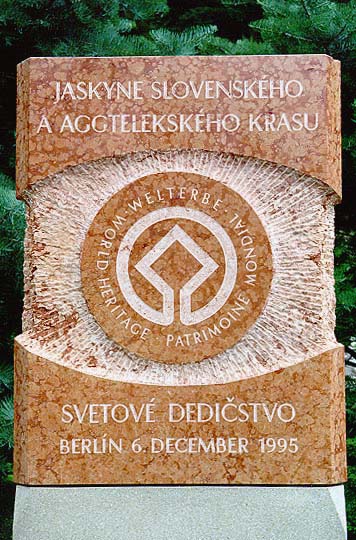
UNESCO
WORLD HERITAGE SITE
Cadastral areal: Ochtiná
District: Rožňava
Region: Košice
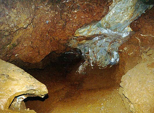
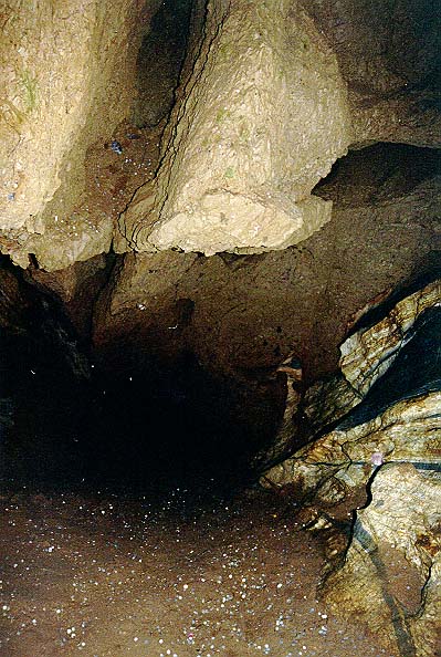
It is situated in the Ochtinský cryptokarst
on the north‑western slope of Hrádok Hill in the Revúcka Highland,
between Jelšava and Štítnik. Access to the cave is through the 145-meter
gallery that opens to the cave spaces at 642 meters above the sea level.
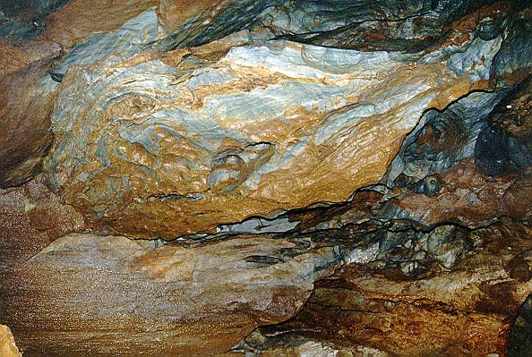
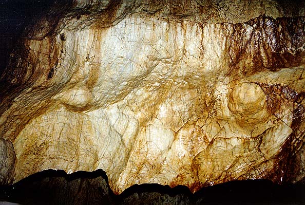
It was formed in a lens of Palaeozoic
crystalline limestone (Lower Devonian‑ Upper Silurian) in Devonian
phyllites. A part of the limestones was in the Mesozoic Period in the
Upper Cretaceous hydro terminally transformed into ankerites and
siderites.
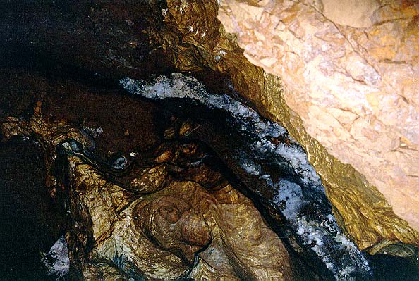
The atmospheric water seeping along the
tectonic faults caused their weathering and the creation of ochres
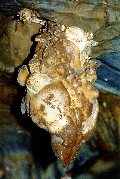
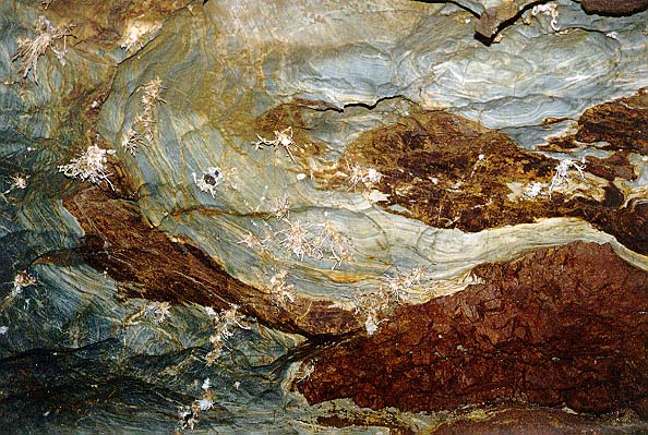
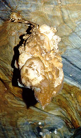
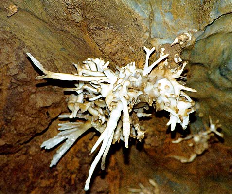
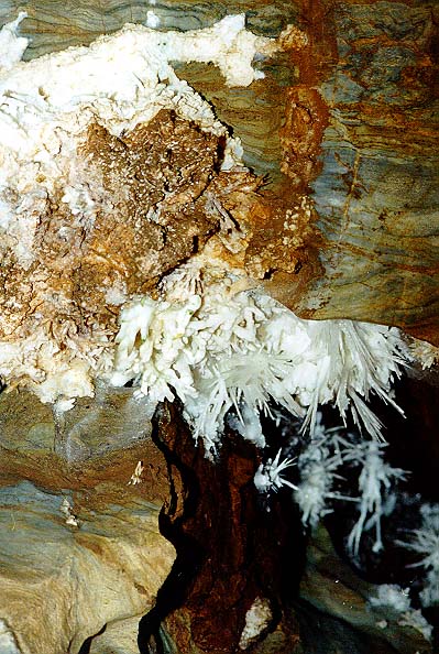
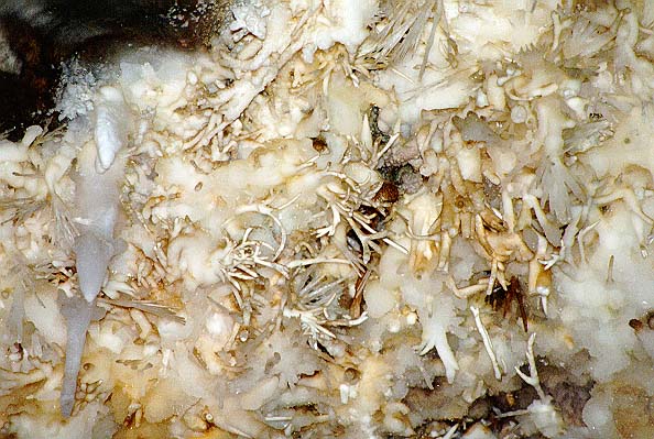
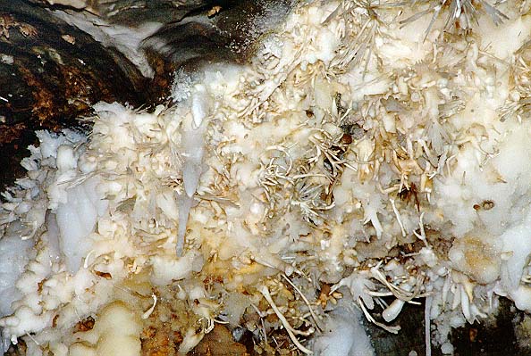
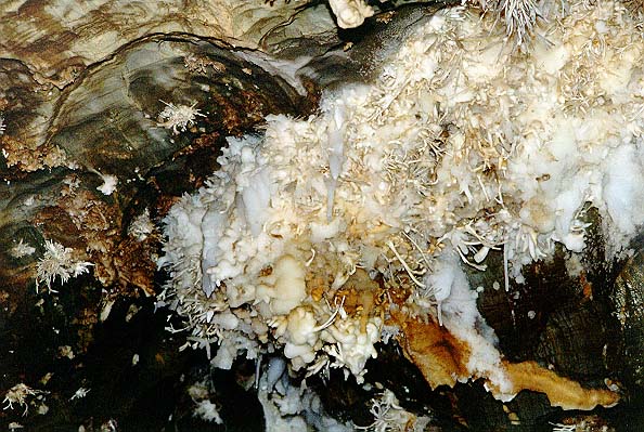
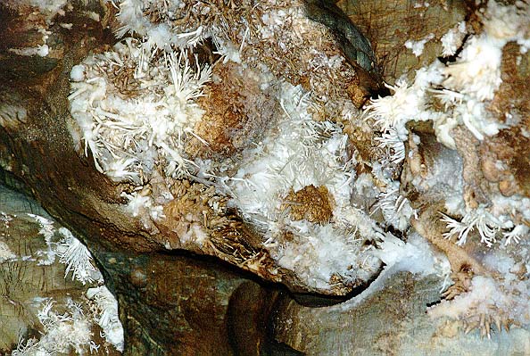
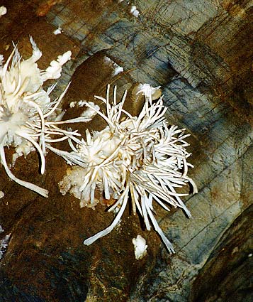
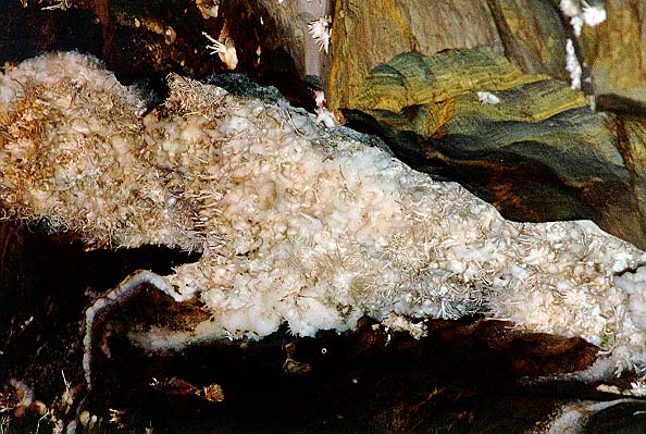
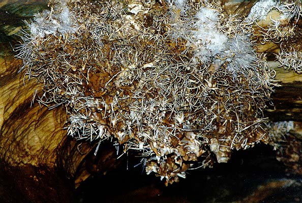
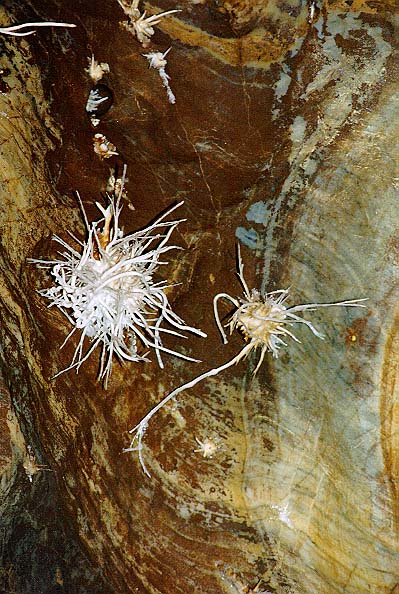
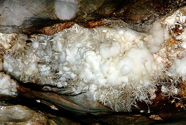
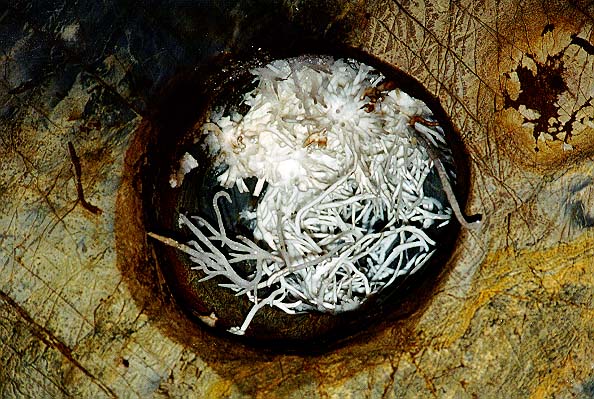
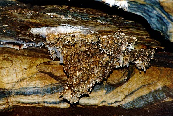
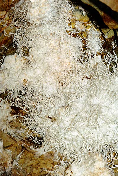
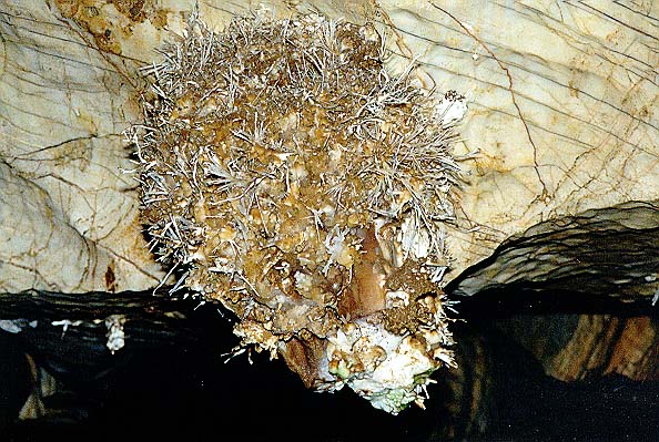
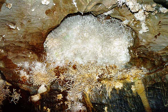
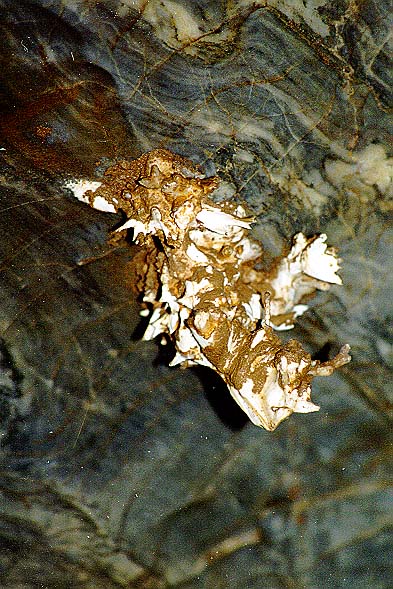
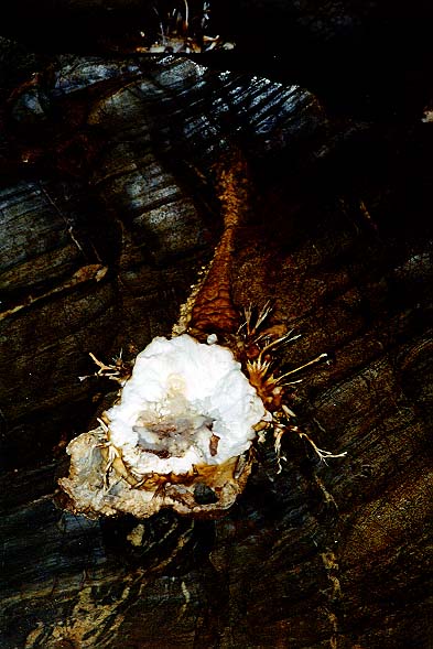
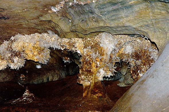
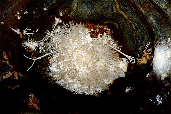
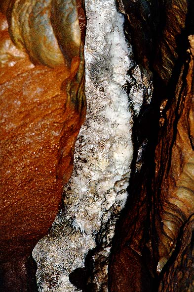
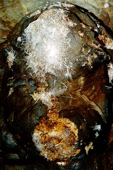
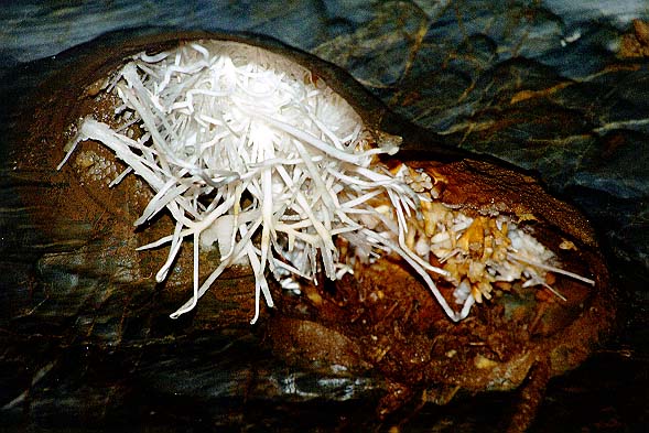
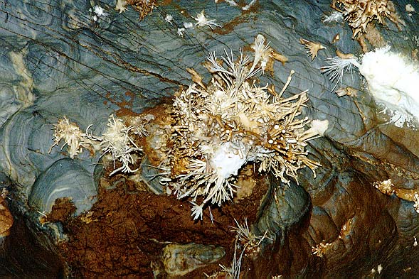
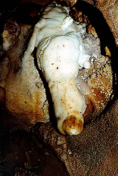
that were later flowed away. Overall length of the cave is 300
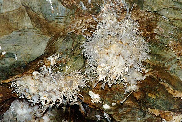
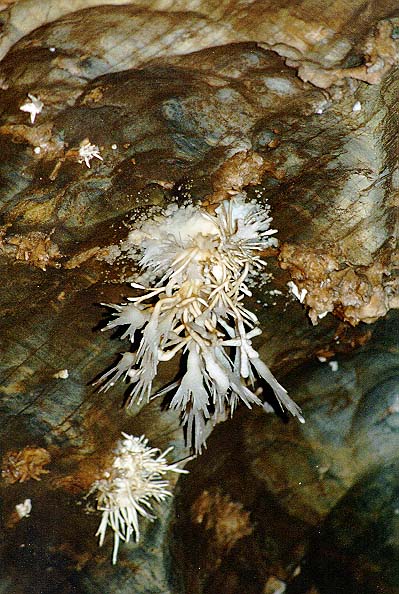
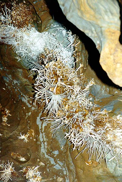
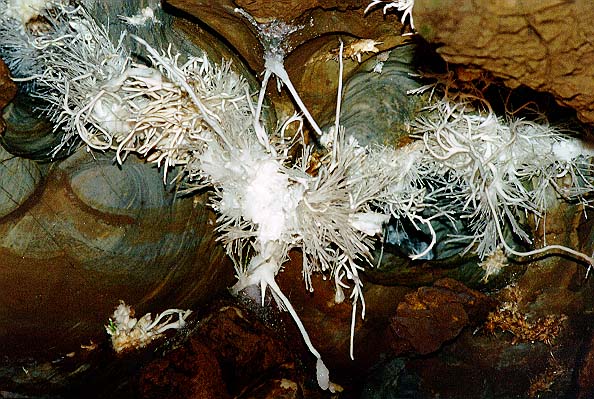
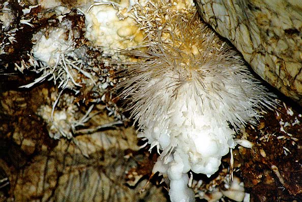
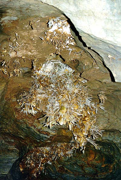
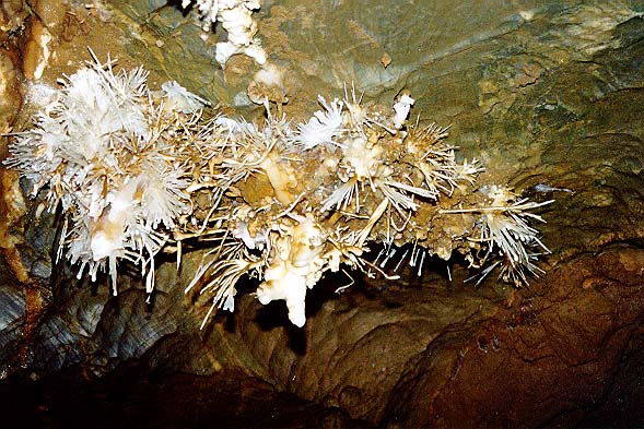
meters. Rich aragonite filling was formed under specific hydro
chemical and climatic conditions in closed underground spaces.
It occurs in
kidney‑shaped, needle‑shaped and spiral forms. The cave was
discovered in 1954 by chance, when driving a new geologic
exploratory gallery, by M. Cangár and J. Prošek. It was open to the
public in 1972 in the length of 230 meters.
GO
TO SLOVAKIA'S CAVES
GO TO SLOVAKIA'S UNESCO WORLD
HERITAGE SITES
Published in the Slovak Heritage Live
newsletter Volume
13, No.3, Fall 2005
Copyright © Vladimir Linder 2004
3804 Yale Street, Burnaby, British Columbia, Canada V5C 1P6
The above article and photographs may not be copied,
reproduced, republished, or redistributed by any means including
electronic, without the express written permission of
Vladimir
Linder. All rights
reserved.
|